Swartvast adviseert bij innovatieve inwinnings- en verwerkingsprocessen van geo-informatie, analyse van data en informatie en de vertaling daarvan naar welgeformuleerde publicaties
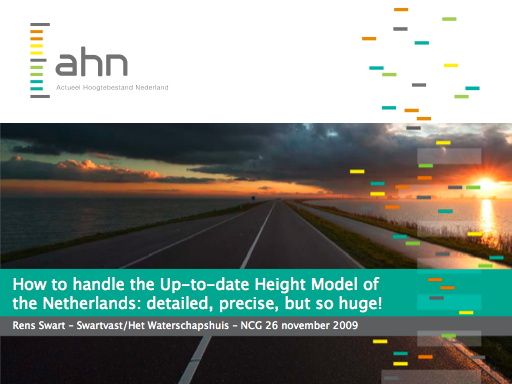
Contribution on AHN at NCG seminar 'Management of massive point cloud data: wet and dry'
Seminar 'Management of massive point cloud data: wet and dry'
26 November 2009
The Subcommissions Marine Geodesy and Core Spatial Data of the Netherlands Geodetic Commission (see below) jointly with Oracle and the Oracle Gebruikersclub Holland organized a seminar on 26 November 2009 about the challenges caused by the ever increasing amount of data that is generated by modern sensor systems, both marine (multi-beam echo) and land (lidar). Because these methods have much in common, the perspective of both the wet and the dry will be combined. The idea is to explore common issues and exchange knowledge. In addition, during the seminar the perspective of development of science and technology could become clear in order to facilitate and simplify the management of extremely large point clouds.
Speakers and audience come from different disciplines and review these extremely large point clouds from their own perspective:
- scientists;
- companies that acquire point clouds (hydrography, laser altimetry);
- companies that develop storage and retrieval systems for point clouds;
- agencies and companies who use these point clouds.
The program can be found on the website of the NCG: see here. There the presentations are available as pdf. The presentation about the AHN can be found below.
This page is also available in Dutch. We are sorry to be unable to present the other Swartvast web pages in English.
Contribution Rens Swart to seminar
Rens Swart, because of his role as project manager of the Up-to-date Height Model of The Netherlands and because of his knowledge of the various scientific disciplines, has been asked by professor Peter van Oosterom (TU Delft, GIS technology) to present on the seminar about the aspects of the AHN in dealing with extremely large point clouds.
Since most speakers and listeners have more knowledge of the technology of handling extremely large point clouds than the AHN-experts, Rens Swart focused on the creation of the AHN and the reason for the recent development of the AHN-2 as a extremely large point cloud. In this the user requirements of in particular the water boards play a major role and are therefore highlighted. It also considered how the water boards address the use of large AHN-2 products in practice.
A complication during the seminar was that, due to the number of speakers, the presentations were limited to 20 minutes. Moreover, this was the first time the public was introduced to (a version of) the new AHN company style. The presentation about the AHN can be found below.
Summary contribution Rens Swart
Ir. L.M.Th. Swart – Swartvast/Het Waterschapshuis – 26 November 2009
The Up-to-date Height Model of The Netherlands (Actueel Hoogtebestand Nederland, AHN) is a digital terrain model of the Netherlands, owned by the 27 water boards and Rijkswaterstaat. It was commenced in 1997 as a joined initiative to obtain a country-wide height model primarily suitable for water management, using the newly available remote sensing technique of laser altimetry. In 2004 it was complete, covering The Netherlands with a density of one height measurement per 1 to 16 square metre.
Partly induced by the increasing requirements of the water boards, partly by offerings of the business, in 2006 the steering committee decided for a new AHN with uprated specifications. In a cycle of five years, the whole of The Netherlands will be covered by a new height model with a precision in height of 5 cm standard deviation and 5 cm systematic error and a density of 8 to 10 points per sq m. Also new is the way the requirements are defined in terms of user needs, and the tendering of both the data acquisition and the quality control of the products.
Till the advent of the new AHN-2, many water boards undertook separate corridor laser mapping in order to acquire the high-precision high-density height data necessary for dike management. The uprated specifications of AHN-2 made it possible to unify the acquisition of height data for both water management and dike management. However, this also causes the amount of data to increase dramatically. In practice often the 0.5 m-grid is used instead of the point cloud. Even then many users must be convinced that this data is, in a way, better than profiles acquired with terrestrial techniques and offer unique opportunities. Apart from that, distribution and use of the distinguished products, including aerial photography, poses a demanding challenge for the users. This challenge will even increase if the AHN is supplied for free and eventually becomes a core spatial dataset.
Presentation Rens Swart
The presentation of Rens Swart can be downloaded as a pdf-document below.

Accompanying paper 'How the Up-to-date Height Model of The Netherlands (AHN) became a massive point data cloud'
Rens Swart – 28 april 2010
To make the impact of the seminar more effective and longer lasting, the NCG will issue a scientific publication including the contributions of the seminar. Rens Swart wrote a paper accompanying the above presentation on the development of the AHN as an extremely large point cloud. This peer reviewed paper was accepted 28 April 2010 for publication in the thematic book that will be issued in the 'green series' of the Netherlands Geodetic Commission.
The paper is supplied below as a pdf-file, layouted in our own style in order to keep the images coloured, as the paper issue is in black and white. The paper is also supplied as a web page for easy reading, see here.
The Netherlands Geodetic Commission
The Netherlands Geodetic Commission (NCG) is the platform of scientists in geodesy and geo-information and promotes both these sciences and the relationship to and meaning to society. The NCG is part of the Royal Netherlands Academy of Arts and Sciences (KNAW).
The NCG now has five subcommissions:
- Core Spatial Data;
- Geodetic Infrastructure and Reference Systems;
- Geo-Information Infrastructure;
- Land Subsidence and Sea Level Change;
- Marine Geodesy.
For further reading
Links to other pages with more information about laser altimetry and the AHN can be found at the top of this page.
Advise and information: contact
As can be seen from this and the other pages, Swartvast has a profound experience with and knowlegde of laser altimetry the AHN. For advise on the use of laser altimetry and the AHN, you are cordially invited to contact me.
Sincerely,
Rens Swart